Framing the Federalist Era: Preserving an 18th Century Map
By Faith Walker, Director, The Great Bend Museum
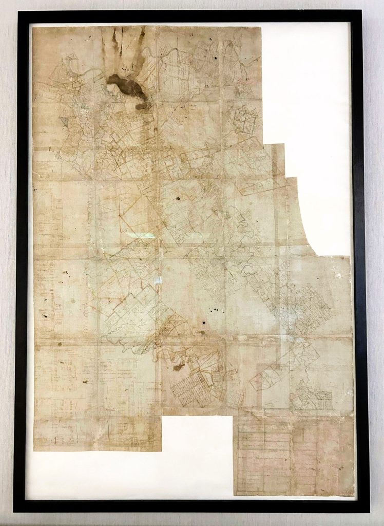
The Great Bend Museum recently completed the conservation and exhibition of its 1796 North American Land Company map, the first known map to detail the geography and development of the Mid-Ohio Valley in West Virginia. Thanks to the generous support of the Foundation for Advancement in Conservation (FAIC) and the Tru Vue Conservation & Exhibition Grant, this vital piece of history has been stabilized and made accessible to the public.
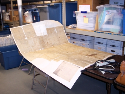
The 40-by-60-inch (101.6 x 152.4 cm) map, executed in iron gall ink on laid paper, represents land holdings from the late 18th century, including tracts once owned by George Washington and Albert Gallatin. Commissioned by the North American Land Company, a large speculative real estate venture founded in 1795, the map played a crucial role in tracking land ownership and availability. The company sought to profit by selling vast tracts of land in Pennsylvania, Virginia, the Carolinas, Georgia, and Kentucky, but ultimately collapsed under the weight of poor management, economic downturns, and the Panic of 1796-1797.
Many of the landowners listed on the map were veterans who had received land grants as compensation for military service, a practice dating back to the colonial era. While these grants facilitated westward expansion, they were often plagued by corruption and unfair distribution. This expansion also came at the expense of Native American communities, including the Shawnee, whose ancestral homeland encompassed the region. The Shawnee resisted encroachment, culminating in the Battle of Point Pleasant in 1774, where they were ultimately forced to cede their lands south of the Ohio River. Continued settlement, conflict, and forced removals led to the erosion of Native American cultural presence in the area. This map captures that changing landscape, illustrating both the opportunities it represented for settlers and the profound displacement it contributed to for Indigenous peoples.
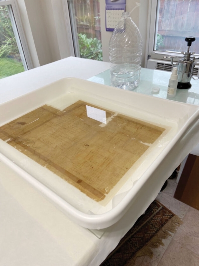
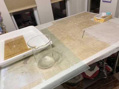
Led by paper conservator Jessica Keister of Steel City Conservation, the conservation treatment involved surface cleaning, washing to reduce discoloration, and stabilizing fragile areas.
The map had been previously lined with canvas, a process dating back to the mid-19th century, which required careful removal. Given its brittle and fragmented condition, the map was disassembled into six sections for individual treatment before being reassembled using Dacron lining, mulberry paper, and wheat starch paste. Significant gaps along fold lines were integrated using precision inpainting.
Following treatment, the museum collaborated with the FrameSmith in Pittsburgh to frame the map in a 2-inch-deep (5.08 cm) custom frame, incorporating 4.5 mm Optium Museum Acrylic glazing and archival mounting techniques. The frame design ensures both stability and optimal viewing conditions, protecting the map from environmental stressors while allowing visitors to appreciate its details.
The museum unveiled the restored map in early 2024, drawing significant public interest. In conjunction with the conservation efforts, the museum hosted a special lecture, “Conservation: The Art and Science of Preserving our Historic Objects,” presented by Keister. This event not only educated attendees about the technical aspects of conservation, but also underscored the museum’s commitment to preserving regional history.
In July 2024, the museum transported the map to the Mountain State Art and Craft Fair, where over 600 visitors engaged with it and learned about its conservation journey. Additionally, a high-resolution digital scan, generously provided by Compucom, allows it to be accessed remotely 24/7.
The conservation of the North American Land Company map represents more than just artifact preservation—it reflects the Great Bend Museum’s broader mission of revitalization and public trust. This project exemplifies the museum’s ongoing dedication to the care and stewardship of its collections, ensuring that historical artifacts remain accessible and well-preserved for future generations.
The Tru Vue Conservation and Exhibition Grant played a crucial role in making this initiative possible, demonstrating the power of conservation funding in ensuring the longevity and accessibility of cultural heritage. By investing in high-quality archival framing and expert conservation services, the museum has secured this remarkable document’s place in the historical narrative of Ravenswood and beyond.
About The Author(s)
Faith Walker
Faith Walker, Director of the Great Bend Museum, Ravenswood, WV
Faith Walker is the Director of the Great Bend Museum in Ravenswood, WV. She holds Bachelor’s Degrees in Anthropology and Art History from Miami University, and is midway through a Master’s Degree in Museum Studies at Johns Hopkins University. Under her leadership, the museum has undertaken significant conservation and interpretation initiatives to enhance public engagement with regional history.