The Challenge
- To find a product to protect the historic map that would minimize the damaging effects of light (and visitors’ fingers).
- The glazing would need to be non-reflective, anti-static and block out UV light.
- Due to the map’s size, weight was an issue; glass would not have been suitable, especially as the area hallmarked for displaying the map was where children congregated.
The Solution
Optium Museum Acrylic®
Acrylic is half the weight of glass and shatter resistant
Safeguards against injury and damage to the map and visitors.
Anti-reflective
Allows viewers to see the map without distracting reflections.
99% UV blocking
Protects the map from the most damaging light wavelengths, helping prevent fading and degradation.
Anti-static protection exceeds that of glass
Immediately eliminates static charge. Makes for safer, easier framing and less cleaning.
Abrasion resistant
A durable hard coat protects against scratches from cleaning and general exposure to the public.
The Work
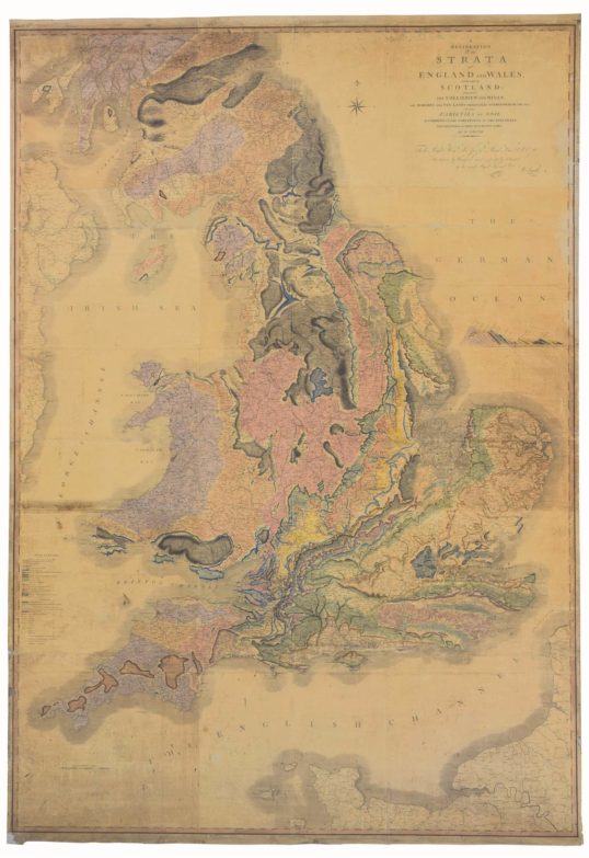
On August 1st, 1815 arguably the most important map ever produced in the United Kingdom was published. It proudly announced itself to the world as “A DELINEATION of the STRATA of ENGLAND and WALES with part of SCOTLAND; exhibiting the COLLIERIES and MINES; the MARSHES and FEN LANDS ORIGINALLY OVERFLOWED BY THE SEA; and the VARIETIES of Soil according to the Variations in the Sub Strata; ILLUSTRATED by the MOST DESCRIPTIVE NAMES”. But the most important name comes next – “By W. SMITH”. This gigantic colourful map, measuring 8 ½ feet by 6 feet, documenting in detail for the first time the geology of England and Wales, was the culmination of years of work by one man, civil engineer, canal surveyor and self-made geologist, William Smith (1769-1839).
More Info
- Read our QuickVue articles on the map’s conservation treatment and preparation for display by Museum Conservation Services.